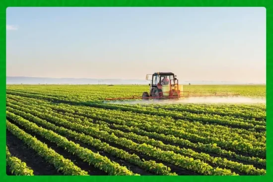
There is a quiet urgency humming through Kenya’s highland coffee belts. Tractors and motorbikes are pausing while technicians on foot open mapping apps. Cooperative leaders are lining up to show GPS coordinates. At the heart of this flurry is a simple, high stakes question: can Kenya prove its coffee was not grown on land cleared after December 31, 2020, so farmers keep access to the European market they rely on?
What is at stake
The European Union Deforestation Regulation, known as EUDR, requires exporters to demonstrate that certain commodities entering the EU were not produced on recently deforested land. Kenya has committed to full traceability for coffee by December 30, 2025. Missing that deadline could jeopardize exports worth billions and the livelihoods of hundreds of thousands of farmers.
Where the country stands now
Since the mapping drive began in July, Kenya has already geo-mapped more than 30 percent of its coffee area, covering 16 of the country’s 33 coffee-growing counties. The initial field work has targeted hotspots such as Subukia, Bahati and Rongai sub-counties in Nakuru, where officials and local farmers are working side by side to validate satellite imagery on the ground.
A whole of government effort
This is not a single agency project. The EUDR Data Committee bringing the work together includes the State Department of Agriculture, the State Department for Cooperatives, the Kenya Forest Service, the Kenya Space Agency, the Directorate of Resource Surveys and Remote Sensing, and the Kenya Agriculture and Livestock Research Organization. The Agriculture and Food Authority is coordinating the work and has been clear that data collection will be done at no cost to farmers.
Why geo-mapping matters for everyday people
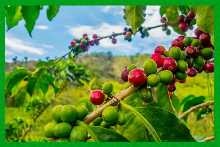
Numbers tell part of the story. Kenya exports roughly 95 per cent of its coffee, and around 55 the of that goes to the European Union. Over the past five years, per cent the country shipped about 122,699 metric tonnes of clean coffee to EU markets, a trade worth close to USD 695.7 million, roughly KES 90 billion. Those figures are not abstract. They represent market contracts, wages, school fees and the local shops in towns that depend on harvest season.
Smallholder farmers produce roughly 70 percent of Kenya’s coffee. That means the success or failure of geo-mapping is a smallholder story: can community cooperatives learn to pin farm polygons on a map, collect validating photos, and embed legal declarations into the supply chain so their coffee passes EUDR checks? If they can, the result is continued access to premium buyers. If they cannot, the result could be lost contracts and fragile rural incomes.
The technical and human hurdles
Geo-mapping looks modern, but the work is demanding. Satellite imagery must be converted into farm-level polygons. Field teams must GPS-verify boundaries and capture metadata that proves there was no recent tree clearing. Data protection rules must be observed. Many smallholders are unfamiliar with the apps and the paperwork. Connectivity gaps and limited local technical capacity make on-the-ground validation slow in some counties. The government’s approach pairs remote sensing with boots-on-the-ground validation, and it is coordinating training to speed uptake.
What success could look like
If Kenya completes mapping and validation by the deadline, exporters will be able to supply accurate due diligence statements to EU importers, and coffee buyers will have confidence that beans are deforestation free since the cutoff date. For farmers, that would mean retained market access, continued premiums for quality beans, and greater bargaining leverage for cooperatives that can demonstrate traceability. For the sector as a whole, it could mean a stronger reputation for sustainability that opens doors to additional markets.
Risks and how to reduce them
The principal risks are timing, quality of data, and inclusion. If mapping is rushed, errors may create disputes. If smallholders are left behind, entire cooperatives could lose market access. The solution is practical: ramp up field validation teams, distribute simple training materials in local languages, fund county-level enumerators, and create help desks so farmers can check their farm polygons and correct mistakes quickly. The government’s pledge to cover mapping costs for farmers addresses part of the problem, but donor and private sector support for training and digital tools will be crucial.
A chance to modernize the sector
Beyond compliance, geo-mapping is an opportunity. Accurate farm-level data can power better agronomy advice, targeted financing, and more transparent quality chains. Cooperatives that learn digital record keeping can tie traceability to certified premiums. Investors and development partners often prefer projects with clear geospatial evidence. In that sense, the mapping push can be a stepping stone from compliance to competitiveness.
The deadline is close but not impossible. What will determine Kenya’s success is not just satellites and apps but relationships. It is the trust between extension officers and farmers, the willingness of cooperatives to lean into digital tools, and the ability of government to turn maps into verified, usable data that buyers accept. If the process finishes strong, Kenya will protect a vital export market and hand smallholder farmers a digital ledger that keeps their work visible and valued on the global stage.
Stay updated with the latest farming tips and agriculture industry news from Africa by subscribing to our newsletter. Don’t miss out on valuable insights and updates. Follow us on Twitter, LinkedIn, and Facebook to join our farming community and stay connected with us.